Are you a real estate developer preparing to launch a large-scale project? Or maybe you’re a future homeowner eager to start building your dream house? No matter which side you’re on, one of the very first steps before any construction begins is the topographic survey.
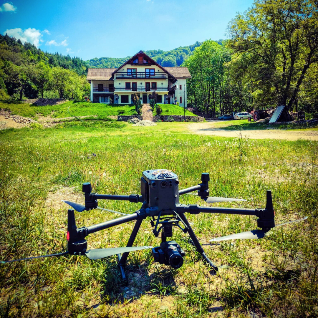
These surveys define exactly where your land begins and ends, how it is shaped, what elevation differences exist, and what potential risks or challenges may arise. That’s why topographic measurements must be carried out precisely, by authorized specialists using modern equipment.
In this article, you’ll discover what topography in construction really means, why it is so important, and how the Dromcons team, with over 20 years of expertise, can support your project.
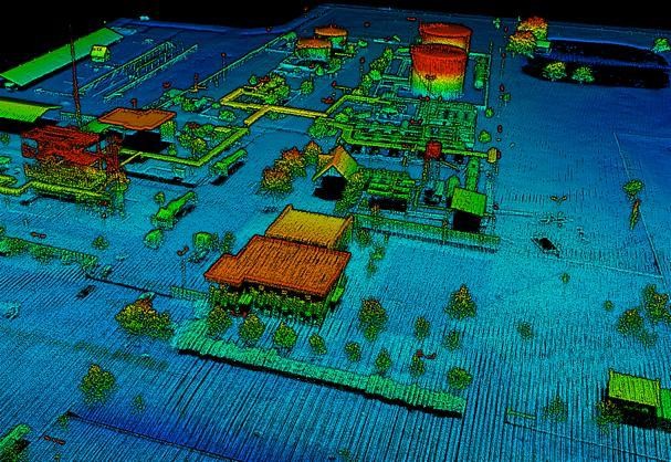
A topographic survey is a set of techniques used to collect essential data about your land—its shape, boundaries, elevation differences, and relationship with neighboring areas. This data is then translated into a topographic plan, a graphic representation of the terrain.
In other words, the surveyor “translates” the land into coordinates and technical drawings, which are crucial for designers, authorities, and builders.
Through topographic surveys, you’ll learn:
Imagine you place a fence “by eye” without proper measurements. Later, during registration, you discover you’ve encroached 40 cm onto your neighbor’s land. That means extra costs, legal disputes, and wasted time.
If surveys are not performed correctly, issues can arise from several angles:
Romanian law requires property owners to submit a topographic survey to obtain a construction permit. Authorities review these documents and approve the project only if it complies with zoning regulations.
Once you have the permit, the land must be staked. This means the surveyor marks exactly where the house, foundations, and utility routes will be. This ensures your builder knows precisely where to dig, without intersecting other networks.
The OCPI (County Office for Cadastre and Real Estate Publicity) and ANCPI (National Agency) validate topographic plans. These are mandatory for cadastral documentation or for registering land in the Land Book. For example, converting agricultural land into buildable land requires such a plan.
Large-scale projects, like logistics halls, require extreme precision. GPS surveys provide centimeter-level accuracy across large areas—essential for industrial and infrastructure projects.
For complex projects, Dromcons offers advanced surveying services, including:
Here are the main steps:

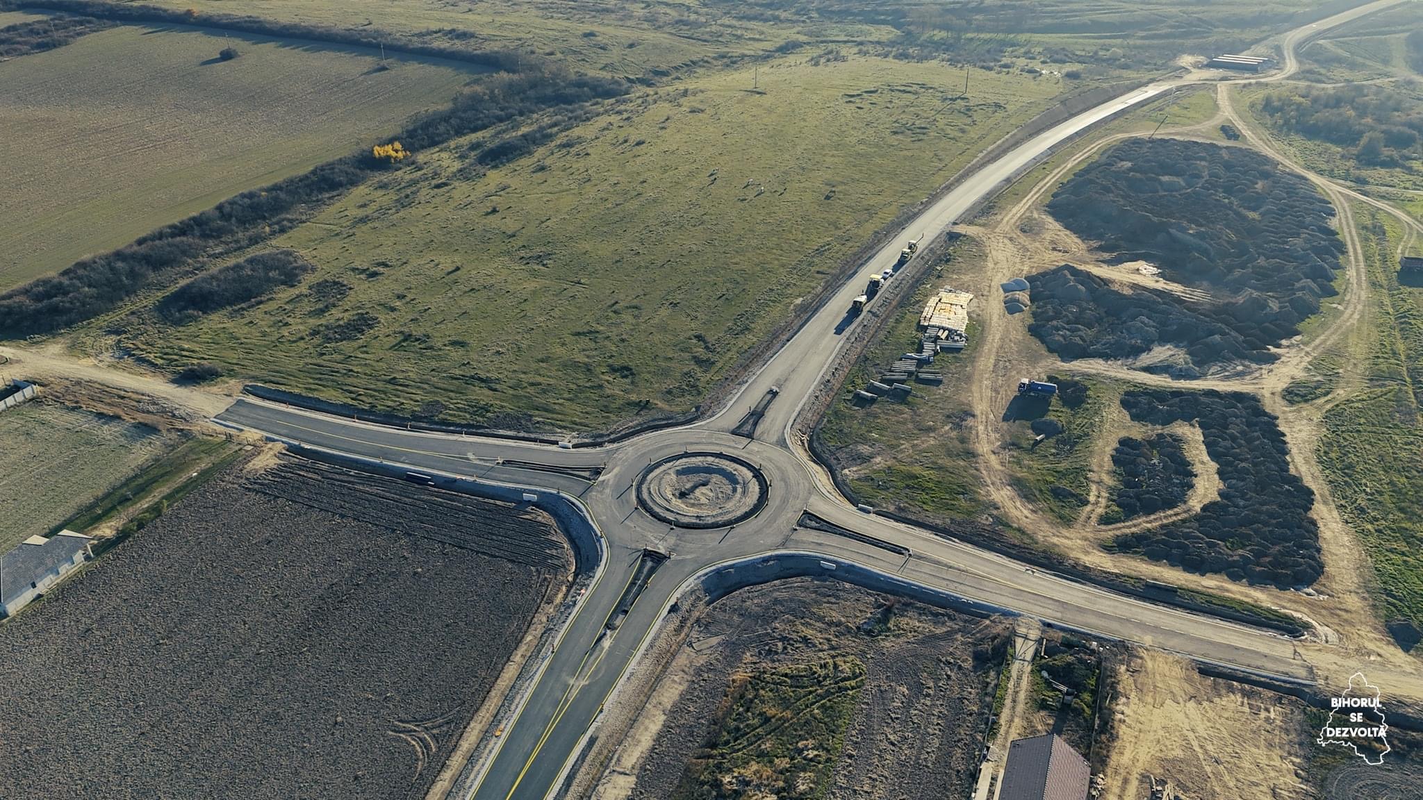
1) Arad East Bypass Road – 11 km of road, 7 intersections, and auxiliary works. Detailed topographic surveys and 75 geotechnical drillings ensured accuracy and safety.
2) Oradea Metropolitan Ring Road – 8 km road and 3 intersections. Extensive surveys and geotechnical studies guaranteed a durable and regulation-compliant result.
See more in our project portfolio.
Also explore our road and bridge design services.
Without precise topographic surveys, any construction project risks delays, extra costs, or even structural issues. With Dromcons, you get accurate land analysis, legal compliance, and a safe foundation for your project.
Do you own land or plan to build? Contact Dromcons for fast and precise topographic surveys!
 +40357 804 071
 office@dromcons.ro
 Str. Vasile Milea 44, Arad
 Romanian
 +40357 804 071
 office@dromcons.ro
 Str. Vasile Milea 44, Arad